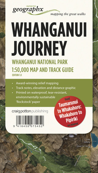
Great Walks of New Zealand Map Series : Whanganui Journey
- Unit price
- / per
-
Author:
-
ISBN:9416458075452
-
Publication Date:January 2014
-
Edition:1
-
Pages:
-
Binding:Paperback
-
Publisher:Potton and Burton
-
Country of Publication:


A Back Order button means that we don’t have the book in stock at our store. It may already be on order – or we can order it for you from a publisher or distributor at no additional cost.
As we source items from around the globe, a back-order can take anywhere from 5 days to several weeks to arrive, depending on the title.
To check how long this might take, you’re welcome to contact us and we can provide an ETA or any other information you need. We recommend checking the timeframe before committing to an online order.
Great Walks of New Zealand Map Series : Whanganui Journey
- Unit price
- / per
-
Author:
-
ISBN:9416458075452
-
Publication Date:January 2014
-
Edition:1
-
Pages:
-
Binding:Paperback
-
Publisher:Potton and Burton
-
Country of Publication:
Description
FOLDED MAP
Edition 1 2014
Scale 1:50,000
The Whanganui River winds its way from the mountains to the Tasman Sea through countless hills and valleys. This journey lets you take a multi-day canoe or kayak trip to experience its most remote scenic beauty, history and cultural significance.
The Whanganui Journey passes through Whanganui National Park, in the south-west of the North Island, and is very accessible from State Highway 4 (SH4). Choose a 5 day journey from Taumarunui to Pipiriki (145 km), or a shorter, 3 day journey starting at Whakahoro (87 km), featuring the most scenic stretches of the river.
Features:
- Taumarunui to Whakahoro 3D Map on Front – Whakahoro to Pipiriki 3D Map on reverse
- 145 km and 203 rapids of grade 1 and 2 canoeing
- Award-winning relief mapping
- Printed on waterproof, durable, environmentally sustainable ‘Rockstock‘ paper.
Adding product to your cart
You may also like
A Back Order button means that we don’t have the book in stock at our store. It may already be on order – or we can order it for you from a publisher or distributor at no additional cost.
As we source items from around the globe, a back-order can take anywhere from 5 days to several weeks to arrive, depending on the title.
To check how long this might take, you’re welcome to contact us and we can provide an ETA or any other information you need. We recommend checking the timeframe before committing to an online order.
You may also like
You may also like
-
FOLDED MAP
Edition 1 2014
Scale 1:50,000The Whanganui River winds its way from the mountains to the Tasman Sea through countless hills and valleys. This journey lets you take a multi-day canoe or kayak trip to experience its most remote scenic beauty, history and cultural significance.
The Whanganui Journey passes through Whanganui National Park, in the south-west of the North Island, and is very accessible from State Highway 4 (SH4). Choose a 5 day journey from Taumarunui to Pipiriki (145 km), or a shorter, 3 day journey starting at Whakahoro (87 km), featuring the most scenic stretches of the river.
Features:
- Taumarunui to Whakahoro 3D Map on Front – Whakahoro to Pipiriki 3D Map on reverse
- 145 km and 203 rapids of grade 1 and 2 canoeing
- Award-winning relief mapping
- Printed on waterproof, durable, environmentally sustainable ‘Rockstock‘ paper.
-
-
Author:ISBN: 9416458075452Publication Date: January 2014Edition: 1Pages:Binding: PaperbackPublisher: Potton and BurtonCountry of Publication:
FOLDED MAP
Edition 1 2014
Scale 1:50,000The Whanganui River winds its way from the mountains to the Tasman Sea through countless hills and valleys. This journey lets you take a multi-day canoe or kayak trip to experience its most remote scenic beauty, history and cultural significance.
The Whanganui Journey passes through Whanganui National Park, in the south-west of the North Island, and is very accessible from State Highway 4 (SH4). Choose a 5 day journey from Taumarunui to Pipiriki (145 km), or a shorter, 3 day journey starting at Whakahoro (87 km), featuring the most scenic stretches of the river.
Features:
- Taumarunui to Whakahoro 3D Map on Front – Whakahoro to Pipiriki 3D Map on reverse
- 145 km and 203 rapids of grade 1 and 2 canoeing
- Award-winning relief mapping
- Printed on waterproof, durable, environmentally sustainable ‘Rockstock‘ paper.
-
Author:ISBN: 9416458075452Publication Date: January 2014Edition: 1Pages:Binding: PaperbackPublisher: Potton and BurtonCountry of Publication:
-


